Well, there are many ambiguities relating to the 3D Scanning and its services offer what kind of easiness of doing work.
Here is the Why, What, When, Who, Where, and How 3D scanning is required is explained here.
What is 3D scanning? What is a 3D laser scanner? Why 3D Scanning required? Which is the Best 3D mapping equipment?
Well here are the most of the answers for all of your 5W 2H Questions.
We all know that the best 3D Scanner in India or 3D laser scanner in all over the countries is Faro Focus from the brand-named FARO, which basically based in the USA.
Why 3D scanning required? What is 3D scanning? Who are in need of this 3D scanning service? When it should be done (3D scanning)? Where it can be helpful? How it can be beneficial for the end customers? These are the basic questions you might get after reading such a technical word!
Why? – To generate the digital archive which was outdated/vanished over the period of time. To inspect long distances surface and texture along with the measurement of site.
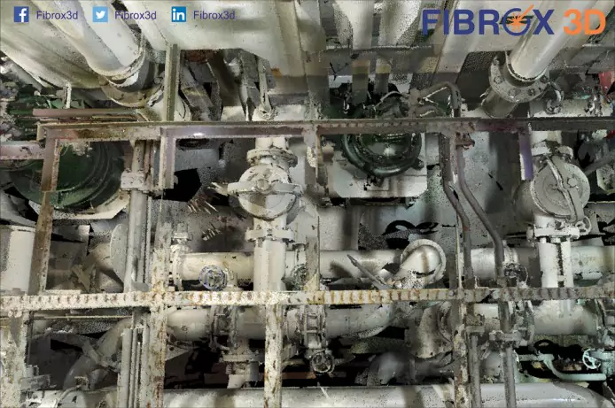
What? – 3D scanning is the technology in the field of GIS (Geographic information system) as it is based on flight time and LiDAR concept to work on the infrastructure sector and many more.
Who? – Engineering Consultants, Plant Engineering Services, Heritage consultants, conservation architects, Heritage conservation government bodies, Marine Engineering consultants & services, BIM consulting firms, MNCs for asset and facility management.
When? – As earliest as possible. Due to so many live examples who are in need to achieve something big; must get the advantage of scanning on time for saving lots of time and manual errors.
Where? – As-built heritage, As-built plant facility, Existing built up museum/historic building for renovation, Royal Place, Area mapping/Surveying, Asset, and facility management – Ballast water treatment system, Scrubber installation/Exhaust Gas recirculation system onboard and much more.
How? – End-user gets point cloud data; which can be used to convert buildings-heritage-historical places into BIM model/Revit 3D model, Plant model to 3D intelligent model, based on that we can opt for 2D drawings & layout, piping & equipment layout, piping and equipment sectional drawings, Elevation drawings, cable tray layout.
Professional 3D scanning of any place/buildings/plant with less than 3mm of accuracy and along with HDR photography gives immense look to project output.
There would be many doubts regarding the size and complexity and how it can work with more accuracy, efficiency, and under time-limit.
Know more:
- How 3D Scanner makes you Feel Relax?
